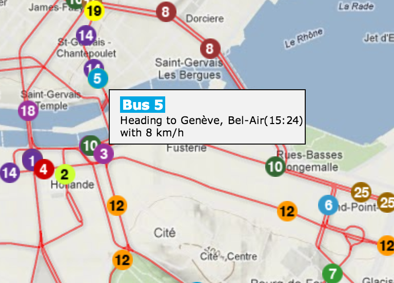
Why we like it: The Genève transit simulator uses Google Maps to simulate the movement of the various transit networks run by TPG in Genève (Geneva).
![](https://lh4.googleusercontent.com/fKlRPOOoXcd7RnVAWO-fWaxW5DcCl0JhDOJaYDmQuuGNgXmD32AUnyXZJKZ0ym9AiAwzIuB6CxF42QebtXLtcVXwwkuuaW7-reTZpHXh9SkWU-LsZPNWEzIX)
The map uses Symbols on Polylines to display the predicted motion of the tram or bus. It uses a ‘mouseover’ event on each of the markers to open an div element displaying more information.
![](https://lh5.googleusercontent.com/BEE6G1GytlaB1YUY8IHYKF5KC9NUfSHHpTrl4wOOoG1CR3D4OWfNt7kIExHxak3B5EgjrfAWd0k1JGZtlULoCuQDyA1LZs1nPoKZPfCtSWWC5yqiPXu9Hv_j)
![](https://lh3.googleusercontent.com/RPgltllx3fQnpLnYZAtg21psW5oPPSMXfxyRxIjnoavcSnTsE3tp4N4iiYI-jlJNbd5oPcC9DJj9Y8Qg984bBaKwuP0--ZknD1OtUJsRUHN38iU66zj_1DLm)
Posted by Mano Marks, Maps Developer Relations Team